PMA Landscape Architects Ltd.
359 Keele St
Toronto, Ontario, M6P 2K6
tel. 416 239 9818 fax. 416 239 1310
design@pmalarch.ca
Mount Dennis BIA Streetscape Master Plan
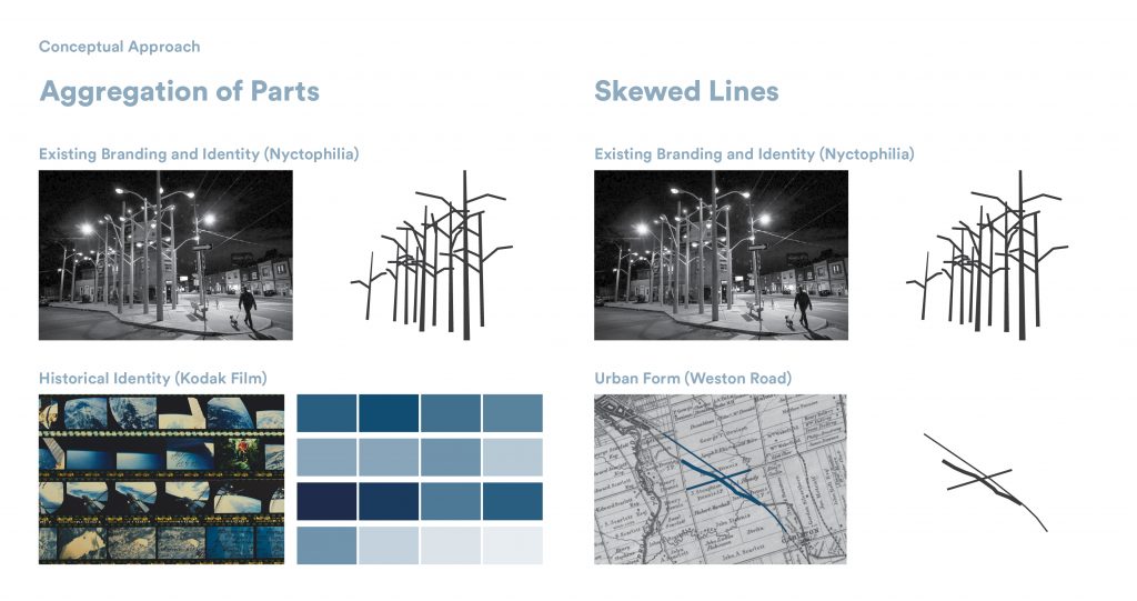
Strategies
Social
Urban Realm
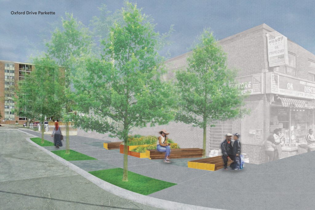
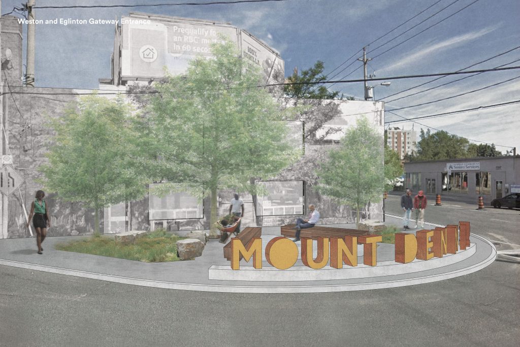
The neighbourhood of Mount Dennis is undergoing a massive change. Wedged between the Canadian-Pacific Rail Corridor to the east and the meanders of the Humber River to the west, this neighbourhood is set to become the second largest transit hub in the City of Toronto with the arrival of the Eglinton LRT. Mount Dennis Station will act as a gateway to the neighbourhood, linking GO Transit Trains, Union-Pearson Express Trains and TTC bus routes. The area developed in the early 20th Century with the arrival of Kodak Heights, a major camera manufacturing factory. The factory situated itself along the railway line running next to Weston Road in an area that was mostly rural until 1913. The neighbourhood of Mount Dennis grew up with and around the Kodak factory, with development concentrated on the main arteries of roads that bisect Mount Dennis including Weston Road and Eglinton Avenue. Today, Mount Dennis is still defined by the growth patterns of the area at that time. In anticipation of the future growth, the Mount Dennis BIA commissioned PMA Landscape Architects to develop a Streetscape Master Plan that would secure a voice at the table when it comes to the future streetscape and inevitable urban intensification in the area. The focus area for the Mount Dennis BIA improvement was along Weston Road, the intersection of Weston Road with Eglinton Avenue and the side street branches which attach themselves to the trunk of Weston Road.
- Toronto, ON
- 1 km
- Streetscape